
User Guide


Garmin G1000 Pilot’s Guide for the Diamond DA40/40F
190-00592-01 Rev. A6-36
HAZARD AVOIDANCE
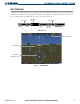
• STANDBY – when the Traffic Map Page displays ‘STANDBY’ in the status box located in the upper left
corner of the Traffic Map Page, the TIS system is in standby mode and cannot display traffic data.
• OPERATE – when the Traffic Map Page displays ‘OPERATE’ in the status box located in the left corner of
the Traffic Map Page, the TIS system is in operational mode and available to display traffic.
The pilot can switch between Standby (STBY) and Operating (ON) modes to manually override automatic
operation using the page menu or softkeys.
Switching between operating modes:
1) Press the
MODE
Softkey.
2) Press the
STANDBY
or
OPERATE
Softkey to switch between modes. ‘TIS STANDBY’ or ‘TIS OPERATING’ is
displayed in the status box located in the upper left corner of the Traffic Map Page,
OR:
3) Press the
MENU
Key. The page menu is displayed with ‘Standby Mode’ or ‘Operate Mode’ highlighted. Press
the
ENT
Key on the desired selection.
TIS AUDIO ALERT
A TIS audio alert is generated whenever the number of TAs on the Traffic Map Page increases from one scan
to the next. Limiting the TAs only reduces the amount of “nuisance” alerting due to proximate aircraft. For
example, when the first TA is displayed, the pilot is alerted audibly. So long as a single TA aircraft remains on
the TIS display, no further audio alert is generated. If a second (or more) TA aircraft appear on the display,
a new audio alert is sounded. If the number of TAs on the TIS display decreases and then increases, a new
audio alert is sounded.
TIS audio alert is also generated whenever TIS service becomes unavailable. The volume of the audio alert
(including the choice between a male or female voice) is configured during installation.
The following TIS audio alerts are available:
• “Traffic” - TIS traffic alert is received.
• “Traffic Not Available” - TIS is not available or out of range.
TIS TRAFFIC STATUS
The MFD indicates the following TIS traffic status to the pilot in the Traffic Banner in the lower left corner
of the map. These statuses are a subset of all possible system statuses and only include traffic information.
• AGE - if traffic data is not refreshed within six seconds, an age indicator (‘AGE MM:SS’) is displayed in
the lower left corner of the display (when displaying traffic). After another six seconds, if data is still not
received, the traffic is removed from the display. The quality of displayed traffic is reduced as the AGE
increases.
• TRFC COAST - indicates that displayed traffic is held even though the data is stale. The quality of displayed
traffic is reduced when TRFC COAST is displayed.