
Cockpit Reference Guide


Garmin G1000H
™
Cockpit Reference Guide for the Bell 407GX
190-01254-00 Rev. B
60
Hazard Avoidance
Flight
InstrumentsEICAS
Nav/Com/
XPDR/AudioAFCSGPS Nav
Flight
PlanningProcedures
Hazard
Avoidance
Additional
Features
Abnormal
Operation
Annun/
AlertsAppendixIndex
4)
Turn the large FMS Knob to highlight the desired coverage option(s)
and press the
ENT
Key to check or uncheck one of more of the following
coverage selections:
•
PRESENT POSITION – Requests data based on current location.
•
DESTINATION – Requests data based on active flight plan
destination (if the flight plan contains no destination, dashes ‘------” are
displayed.)
•
FPL – Requests data based on active flight plan. Turn the small
FMS Knob to select the desired flight plan look-ahead distance
option (or choose ‘REMAINING FPL’ to request the remainder of the
flight plan).
•
WAYPOINT – Requests data based on any valid waypoint.
5)
Turn the large FMS Knob highlight to the ‘DIAMETER / RTE WIDTH’
distance field and turn the small FMS Knob to select the desired diameter
and route width of the request, then press the
ENT
Key.
6)
Turn the large FMS Knob until the ‘SEND REQ’ button is highlighted. Press
the
ENT
Key to initiate the request immediately or press the FMS Knob to
return to the GFDS Data Link Page without requesting data.
During a GFDS Data Request, the Request Status box initially displays “Contacting
GFDS...”. Once a connection is established, the Request Status Box displays “Receiving
Wx Data... Time Remaining:” with an estimated data transfer time (either minutes or
seconds). If desired, the GFDS Data Request window may be closed while the data request
is processing by pressing the FMS Knob; the data request will continue to process in the
background. GFDS Data Requests typically take between 1 to 4 minutes to complete
depending on the size of the selected weather coverage area and Iridium signal strength.
The system retrieves all available Worldwide Weather products within the selected
coverage area during an initial GFDS Data Request, regardless of which products (if
any) are currently enabled for display. On subsequent requests, previously retrieved
textual data (such as METARs and TAFS) is retained if it has not expired, while new
textual weather data matching the current coverage area and all graphical weather data is
downloaded during every data request.
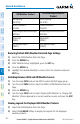
If the system cannot complete a GFDS weather data request, one or more messages
will appear in the request status window as shown in the following table.