
Owner's Manual

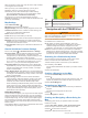


Table Of Contents
- Owner’s Manual
- Table of Contents
- Introduction
- Customizing the Chartplotter
- ActiveCaptain® App
- Sonar Fishfinder
- Traditional Sonar View
- Garmin ClearVü Sonar View
- SideVü Sonar View
- Split-Screen Frequency
- Flasher
- Split-Zoom View
- Selecting the Transducer Type
- Sonar Frequencies
- Creating a Waypoint on the Sonar Screen Using the Device Keys
- Pausing the Sonar
- Adjusting the Zoom
- Sonar Gain
- Adjusting the Range of the Depth Scale
- Sonar Setup
- Garmin Quickdraw Contours Mapping
- Navigation with the STRIKER Vivid
- Searching for a Destination by Name
- Creating a Waypoint on the Map
- Navigating to a Waypoint
- Creating and Navigating a Route Using the Map
- Stopping Navigation
- Waypoints
- Routes
- Tracks
- Showing Tracks
- Clearing the Active Track
- Saving the Active Track
- Viewing a List of Saved Tracks
- Editing a Saved Track
- Saving a Track as a Route
- Browsing for and Navigating a Recorded Track
- Deleting a Saved Track
- Deleting All Saved Tracks
- Retracing the Active Track
- Setting the Color of the Active Track
- Managing the Track Log Memory During Recording
- Configuring the Recording Interval of the Track Log
- Device Configuration
- Sharing and Managing User Data
- Appendix
- Index
- Quick Start Manual
- STRIKER™ Vivid 5/7/9 Fixed Bail Mount
- Important Safety & Product Information

fills the track log faster. The resolution interval is recommended
for the most efficient use of memory.
1
Select User Data > Tracks > Active Track Options >
Record Interval > Interval.
2
Select an option:
• To record the track based on a distance between points,
select Distance > Change, and enter the distance.
• To record the track based on a time interval, select Time >
Change, and enter the time interval.
• To record the track plot based on a variance from your
course, select Resolution > Change, and enter the
maximum error allowed from the true course before
recording a track point.
Device Configuration
System Settings
Select Settings > System.
Display: Adjusts the backlight brightness (Adjusting the
Backlight, page 2) and color scheme (Adjusting the Color
Mode, page 2).
Beeper: Turns on and off the tone that sounds for alarms and
selections (Setting the Beeper, page 2).
GPS: Provides information about the GPS satellite settings and
fix.
Auto Power: Turns on the device automatically when power is
applied.
Keyboard Layout: Sets the arrangement of the keyboard to an
alphabetical or computer keyboard layout.
Language: Sets the on-screen language.
System Information: Provides information about the device and
the software version.
Simulator: Turns on the simulator and allows you to set the
speed and simulated location.
System Information
Select Settings > Settings > System Information.
Event Log: Allows you to view a log of system events.
Software Information: Provides information about the device
and the software version.
Garmin Devices: Provides information about connected Garmin
devices.
Reset: Restores the device to factory settings.
NOTE: This deletes any setting information you have
entered.
My Vessel Settings
NOTE: Some settings and options require additional hardware.
Some settings are available only when you have valid depth
data.
Select Settings > My Vessel.
Transducer Type: Displays the type of transducer connected to
the device (Selecting the Transducer Type, page 4).
Keel Offset: Offsets the surface reading for the depth of a keel,
making it possible to measure depth from the bottom of the
keel instead of from the transducer location (Setting the Keel
Offset, page 11).
Temp. Offset: Compensates for the water temperature reading
from a temperature-capable transducer (Setting the Water
Temperature Offset, page 11).
Setting the Keel Offset
You can enter a keel offset to compensate the water depth
reading for the transducer installation location. This allows you
to view the depth of the water below the keel or the true depth of
the water, depending on your needs.
If you want to know the water depth below the keel or the lowest
point of your boat and the transducer is installed at the water
line or anywhere above the end of the keel, measure the
distance from the transducer location to the keel of the boat.
If you want to know the true water depth and the transducer is
installed below the water line, measure the distance from the
bottom of the transducer up to the water line.
NOTE: This option is only available when you have valid depth
data.
1
Measure the distance:
• If the transducer is installed at the water line or
anywhere above the end of the keel, measure the
distance from the transducer location to the keel of the
boat. Enter this value as a positive number.
• If the transducer is installed at the bottom of the keel
and you want to know the true depth of the water,
measure the distance from the transducer to the water
line. Enter this value in as a negative number.
2
Select Settings > My Vessel > Keel Offset.
3
Select if the transducer is installed at the water line, or
select if the transducer is installed at the bottom of the
keel.
Setting the Water Temperature Offset
You can set the temperature offset to compensate for the
temperature reading from a temperature-capable sensor.
1
Measure the water temperature using the temperature-
capable transducer that is connected to the device.
2
Measure the water temperature using a different
thermometer or temperature sensor that is known to be
accurate.
3
Subtract the water temperature measured in step 1 from the
water temperature measured in step 2.
This is the temperature offset. Enter this value in step 5 as a
positive number if the sensor connected to the device
measures the water temperature as being colder than it
actually is. Enter this value in step 5 as a negative number if
the sensor connected to the device measures the water
temperature as being warmer than it actually is.
4
Select Settings > My Vessel > Temp. Offset.
5
Use the arrow keys to enter water temperature offset
measured in step 3.
Device Configuration 11