
User Guide


Microsoft Flight Simulator 98 — Pilot’s Guide
39
Filename: 17316_04.doc Project: Visual User's Guide Template
Template: FS98.dot Author: Larry Boler Last Saved By: Larry Boler
Revision #: 26 Page: 39 of 25 Printed: 07/01/97 01:13 PM
Printed On: Distiller Colorlayer: ? Document Page: 39
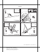
New York
28
10
2501 X 100
Elevation
Coordinates
No ATIS or CT
109
41°10'N
71°35'W
Block Island, Rhode Island
Block Island State
AIRPORT CHART
For use with
Microsoft Flight Simulator
F
VAR 15° W
N
33
L
4
L
9
4
R
22
L
15
R
22
R
27
F
15
L
33
R
Elevation
Coordinates
ATIS
20
42°22'N
71°00'W
135.0
Boston, Massachusetts
General Edward Lawrence Logan International (BOS)
AIRPORT CHART
For use with
Microsoft Flight Simulator
7860 X 150
10005 X 150
7000 X 150
10081 X 150
2557 X 100
F
CT
VAR 16° W
N
IAF
NANTUCKET
116.2 ACK -------
Chan 109
VAR 16° W
MISSED APPROACH
Climb to 800, then climbing left,
turn to 2500 via MVY R-180
to CLAMY Int.
0.6
MM
BORST INT
I-MVY 5 DME
1407
1500
GS 3.00°
TCH 50
One Minute
Holding Pattern
3.4 NM
I-MVY 1 DME
1500
056°
236°
Elevation
Coordinates
ATIS
68
41°24'N
70°37'W
126.25
Martha's Vineyard, Massachusetts
Martha's Vineyard (MVY)
AIRPORT CHART
For use with
Microsoft Flight Simulator
N
15
6
3297 X 50
33
24
F
2100
M
S
A
M
V
Y
2
5
N
M
1600
090°
180°
(IAF)
PEAKE
MVY R-056
179
+
-
MM
LOCALIZER 108.7
I-MVY -------
Chan 24
MARTHA'S VINEYARD
114.5 MVY ----------
Chan 92
R-180
90°
270°
1 min
236°
MVY R-057
056°
1500 to Borst Int
I-MVY 5 DME
236° (6.6)
CHOPY INT
I-MVY 11.6 DME
1500
058° (4.2)
1
0
CLAMY
R-270
056°
R-308
R-323
Atlantic Ocean
1500 NoPT
323°
(24.4)
1500 NoPT to
Choppy Int
260° heading (1.1)
and LOC (2.4)
CT
5500 X 150
ILS Rwy 24
Martha's Vineyard (MVY)