
User Manual

17
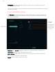
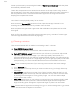
Geotagging tags GPS coordinates of photos inside camera. This button need to be
pressed after drone lands.
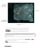
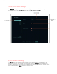
The line at the bottom shows the altitude during the survey and the frequency of images
taken by the camera.
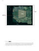
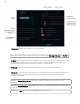
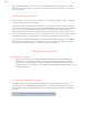
2.1.2 c) GEOFENCE settings
The Geofence tab sets the parameters for the geofence area. Geofence prevents the
drone to fly to unwanted areas. Recommended to use geofence settings according to
your country regulations
Geofence: Turns on/off the geofence feature. It is recommended to set always on
Max Altitude: Maximum allowed altitude for the drone
Return Altitude: When the drone will fly out of the geofence line, drone will return to
home point and will loiter in preset altitude.
Radius: It sets the radius of geofence circle.