
Specifications


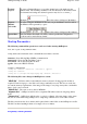


Stuff
Lat/Long Position Formats
It is possible to enter Lat/Long positions in other formats instead of just Degrees and Minutes.
Cursor Move
The cursor can be moved by holding down the shift key and using the arrow
keys
. The map screen must have the focus. If adding waypoints etc holding the
shift key down and pressing the Enter key will add the object.
Events
When
adding Events
using the mouse pointer directly on the map, you can hold
down the Alt key and instead of adding an Event a Waypoint will be added (saves
having to click the buttons on the Toolbar). Conversely when adding Waypoints
holding the Alt key down will add an Event instead.
Map
Comments
See Map Objects below.
Map Features
See Map Objects below.
Map Objects
There are two ways of dragging objects (Waypoints, Events, Map Features or Map
Comments).
Press the Drag button down, press and hold on the object and drag to the
new position.
When the Drag button is not active, the map objects can still be dragged,
you must also hold down the
shift key
when dragging with the mouse.
Map -
Scroll
Scroll the map by dragging with the mouse, hold down the left mouse
button and drag with the mouse.
The map can be scrolled using the keyboard arrow keys. The map screen
must have the focus.
Track Points
When
adding Track Points
to a track use the
Alt key
to start a new track section.
Waypoints
When adding Waypoints using the mouse pointer directly on the map, you can
hold down the Alt key and instead of adding a waypoint an Event will be added
(saves having to click the buttons on the Toolbar). Conversely when adding
Events holding the Alt key down will add a Waypoint instead.
Waypoints
See Map Objects above.
Zoom Levels
The zoom levels can be changed by pressing the PgDn and PgUp keys
. The
map screen must have the focus of course.
Distance
Measurement
To
zero
the
Total Distance field
in the Distance & Bearing window simply
double click on the field itself.
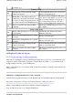
Map Open At
Startup
To open a particular map at Startup, the map name can be passed as a parameter to
OziExplorer. If the map is not local the path and extension (.map) are required.
Position
Display
Right click on the
position display
and
alternate grid display
(above the map) to
change the display format. These changes are not remembered the next time
Oziexplorer is run, use the configuration to do this.
Properties
Window
Double Click
on any
Map Object
(Waypoint, Event, Map Feature or Map
Comment) to open the properties window.
Zoom Window
The
Zoom Window
can be dragged to any position, simple click on it and drag.
Page
212
of
252
OziExplorer Help Contents