
Specifications


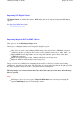


The maps are now ready to use, simply open the map you want to view using the OziExplorer Load
Map menu option.
Options
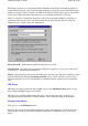
Shift datum
-
Some BSB charts have been georeferenced based on the WGS84 or NAD83 datum
even though the source chart (image) is based on another datum. When this is done the calibration is
correct but the positions displayed do not agree with the grid shown on the map as this grid is based
on the original source map datum. The
Shift Datum
option allows you to change the georeferencing
back to the original source map datum. You cannot choose just any datum, it must be datum the chart
was originally produced in.
Examples
-
Charts produced by
NDI (Canada)
have been georeferenced to NAD83 but the source
datum may have been NAD27 Canada Mean (or similar). BSB topographic maps produced by
Maptrax (Australia)
have been georeferenced to WGS84 but the source datum may have been Aust
geodetic 1966.
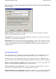
Conditions
-
Not all charts can have the datum shifted.
NDI charts where the source datum is NAD83 or WGS84 will not be shifted, even if you specify a
Shift datum.
Any chart must be georeferenced in NAD83 or WGS84 within the BSB file before it will be
shifted. Charts must meet these conditions before they will have the datum shifted even if you do
specify a Shift Datum.
NOTES :
Some BSB charts use datums which OziExplorer doesn't support, when this happens OziExplorer
will set the Map Datum to "Auto Shift ....." and handle the datum conversions internally. Do not alter
this setting as this could cause the calibration to be incorrect.
Any BSB charts which are imported will have the calibration locked, this means you cannot adjust
the calibration points or corner markers manually. I have had to do this because BSB charts carry the
calibration equations within the header of the chart so adjusting the calibration points will not alter
this, the older charts do not have the equations but may have more calibration points than you are
allowed to adjust manually so again there is no point adjusting only some.
BSB charts can have an unlimited number of calibration points, OziExplorer only uses the first 30 it
finds, this limitation only applies to version 1 charts as version 2 charts have the calibration
equations supplied.
The corner markers cannot be adjusted because there may be more than are allowed to be manually
adjusted, the corner markers are set from the BSB file header.
Importing NOS/GEO Charts
NOS/GEO charts
are similar in format to BSB charts and can be imported using the BSB Import
option.
See
Importing BSB Charts
help.
Page
125
of
252
OziExplorer Help Contents