
User Guide

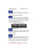


Table Of Contents
- 1. INTRODUCTION
- 2. GETTING STARTED
- 3. AVIATION MODE OPERATION
- BASIC OPERATION
- VFR MOVING MAP FUNCTION
- FLIGHT PLAN FUNCTION
- WEATHER FUNCTION
- HARDWARE ACCESSORY
- RECEIVING WEATHER DATA
- XM WEATHER INFORMATION PRODUCTS
- NEXRAD Composite Reflectivity (USA and Canada)
- Graphical METARs (USA and Canada)
- Graphical PIREPs (USA only)
- Graphical AIRMETs (USA only)
- Graphical SIGMETs (USA only)
- Graphical Conv-SIGMETs (USA only)
- Graphical Winds Aloft (USA only)
- Graphical Freezing Level
- Text METARs (USA and Canada)
- Text TAFs (USA and Canada)
- Text PIREPs (USA only)
- Text AIRMETs (USA only)
- Text SIGMETs (USA only)
- Text Conv-SIGMETs (USA only)
- Legend
- XM OVERLAYS
- TRAFFIC FUNCTION
- AUXILIARY FUNCTION
- SYSTEM SETUP FUNCTION
- 4. AUTOMOTIVE MODE OPERATION
- WARNINGS AND SAFETY INFORMATION
- GLOSSARY
- GETTING STARTED
- SIMPLE AND ADVANCED MODES
- SOFT KEYS AND CONTROLS ON THE SCREEN
- ADVANCED FUNCTIONS
- Smart Zoom
- Position Markers
- Current GPS Position and Lock-on-Road
- Returning to Normal Navigation
- Selected Location (Cursor)
- Original Position in the Cursor Menu
- Daytime and night color schemes
- Color scheme in tunnels
- Route Calculation and Recalculation
- Itinerary
- Track Logs
- Route demonstration
- POI (Points of Interest)
- Saving POI
- Managing POI
- Road Safety Cameras
- Saving Road Safety Cameras
- Camera Warning
- Camera Types
- Camera Directions
- Speed limit warning
- TMC (Traffic Message Channel)
- ADVANCED FEATURES IN GODRIVE VERSION 8.3
- SELECTING THE DESTINATION OF A ROUTE
- Selecting the Cursor as the destination
- Entering an address or part of an address
- Entering an Address (Europe)
- Entering an Address (North America, Australia)
- Entering an Address if house numbering is restarted
- Enter an Address without knowing the district/suburb
- Selecting an Intersection as the Destination
- Selecting a City Center as the Destination
- Entering an Address with a Postal Code
- Tips on Entering Addresses Quickly
- Selecting the destination from your Favorites
- Selecting the destination from the POIs
- Selecting the destination with saved POI search criteria
- Selecting the destination from the History
- Selecting the destination by entering its coordinate
- CREATING A MULTI-POINT ROUTE (INSERTING A VIA POINT)
- CREATING A MULTI-POINT ROUTE (APPEND A NEW DESTINATION)
- EDITING THE ROUTE
- VIEWING WHOLE ROUTE ON THE MAP (FIT TO SCREEN)
- WATCHING THE SIMULATION OF THE ROUTE
- ENABLING SAFETY MODE
- PAUSING THE ACTIVE ROUTE
- DELETING THE NEXT VIA POINT FROM THE ROUTE
- DELETING THE ACTIVE ROUTE
- USING TRACK LOGS
- SELECTING THE DESTINATION OF A ROUTE
- REFERENCE BOOK (ADVANCED MODE)
- 5. MULTIMEDIA
- 6. SYSTEM SETTINGS
- 7. APPENDIX

AV8OR Ace User’s Guide Aviation Mode Operation
VFR Moving Map Function
Pub. No D200904000003 Page 3-31 Rev 1 Jul 2009
© Honeywell International Inc. Do not copy without express permission of
Honeywell.
Time Zone
Abbreviation
Description Offset
from UTC
PDT Pacific Daylight Saving
Time
-7:00
AKS Alaska Standard Time -9:00
AKD Alaska Daylight Saving
Time
-8:00
HAS Hawaii Standard Time -10:00
HAD Hawaii Daylight Saving
Time
-9:00
SST Samoa Standard Time -11:00
SDT Samoa Daylight Saving
Time -
-10:00
Track Angle Error Data Field
The track angle error data window displays the
difference between the desired track and the current aircraft track
over ground in integer degrees. An arrow indicates the direction to
steer to reduce the track angle error.
Track Angle Data Field
The track angle data window displays the track angle of
the aircraft over the ground in integer degrees relative to magnetic
north.
Mini Traffic-Targets Data Window
The mini traffic-targets data window displays a reduced
representation of the main traffic display within a double height data
field. All of the traffic targets are displayed relative to the nose of the
aircraft. The traffic-targets only show when the Map page is in
“Track Up” mode. This prevents confusion between the main Map
page display and the mini traffic display.