
User Guide


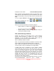

Table Of Contents
- 1. INTRODUCTION
- 2. GETTING STARTED
- 3. AVIATION MODE OPERATION
- BASIC OPERATION
- VFR MOVING MAP FUNCTION
- FLIGHT PLAN FUNCTION
- WEATHER FUNCTION
- HARDWARE ACCESSORY
- RECEIVING WEATHER DATA
- XM WEATHER INFORMATION PRODUCTS
- NEXRAD Composite Reflectivity (USA and Canada)
- Graphical METARs (USA and Canada)
- Graphical PIREPs (USA only)
- Graphical AIRMETs (USA only)
- Graphical SIGMETs (USA only)
- Graphical Conv-SIGMETs (USA only)
- Graphical Winds Aloft (USA only)
- Graphical Freezing Level
- Text METARs (USA and Canada)
- Text TAFs (USA and Canada)
- Text PIREPs (USA only)
- Text AIRMETs (USA only)
- Text SIGMETs (USA only)
- Text Conv-SIGMETs (USA only)
- Legend
- XM OVERLAYS
- TRAFFIC FUNCTION
- AUXILIARY FUNCTION
- SYSTEM SETUP FUNCTION
- 4. AUTOMOTIVE MODE OPERATION
- WARNINGS AND SAFETY INFORMATION
- GLOSSARY
- GETTING STARTED
- SIMPLE AND ADVANCED MODES
- SOFT KEYS AND CONTROLS ON THE SCREEN
- ADVANCED FUNCTIONS
- Smart Zoom
- Position Markers
- Current GPS Position and Lock-on-Road
- Returning to Normal Navigation
- Selected Location (Cursor)
- Original Position in the Cursor Menu
- Daytime and night color schemes
- Color scheme in tunnels
- Route Calculation and Recalculation
- Itinerary
- Track Logs
- Route demonstration
- POI (Points of Interest)
- Saving POI
- Managing POI
- Road Safety Cameras
- Saving Road Safety Cameras
- Camera Warning
- Camera Types
- Camera Directions
- Speed limit warning
- TMC (Traffic Message Channel)
- ADVANCED FEATURES IN GODRIVE VERSION 8.3
- SELECTING THE DESTINATION OF A ROUTE
- Selecting the Cursor as the destination
- Entering an address or part of an address
- Entering an Address (Europe)
- Entering an Address (North America, Australia)
- Entering an Address if house numbering is restarted
- Enter an Address without knowing the district/suburb
- Selecting an Intersection as the Destination
- Selecting a City Center as the Destination
- Entering an Address with a Postal Code
- Tips on Entering Addresses Quickly
- Selecting the destination from your Favorites
- Selecting the destination from the POIs
- Selecting the destination with saved POI search criteria
- Selecting the destination from the History
- Selecting the destination by entering its coordinate
- CREATING A MULTI-POINT ROUTE (INSERTING A VIA POINT)
- CREATING A MULTI-POINT ROUTE (APPEND A NEW DESTINATION)
- EDITING THE ROUTE
- VIEWING WHOLE ROUTE ON THE MAP (FIT TO SCREEN)
- WATCHING THE SIMULATION OF THE ROUTE
- ENABLING SAFETY MODE
- PAUSING THE ACTIVE ROUTE
- DELETING THE NEXT VIA POINT FROM THE ROUTE
- DELETING THE ACTIVE ROUTE
- USING TRACK LOGS
- SELECTING THE DESTINATION OF A ROUTE
- REFERENCE BOOK (ADVANCED MODE)
- 5. MULTIMEDIA
- 6. SYSTEM SETTINGS
- 7. APPENDIX

AV8OR Ace User’s Guide Automotive Mode Operation
Pub. No D200904000003 Page 4-35 Rev 1 Jul 2009
© Honeywell International Inc. Do not copy without express permission of
Honeywell.
Maps sometimes contain information about the speed limits of the
road segments. This information may not be available for your region
(ask your local dealer) or may not be fully correct for all roads on the
map.
You can configure GoDrive to warn you if you exceed the current
limit. Tap the following soft Keys:
, , ,
.
When you exceed the speed limit, the following happens:
• Visible Warning: A symbol with the speed limit appears in
the corner of the map (for example:
).
• Audible Warning: A voice message is played using the
selected voice guidance profile.
TMC (Traffic Message Channel)
GoDrive can provide you with better routes if Traffic Message
Channel (TMC) information is available. The TMC is a specific
application of the FM Radio Data System (RDS) used for
broadcasting real-time traffic and weather information.
TMC is enabled by default in GoDrive.
Note 1: An optional external antenna is available to receive the TMC
service. Refer to the Optional Equipment section on page 2-6.
Note 2: TMC
is not a global service. It may not be available in your
country or region. Ask your local dealer for coverage details.
If public TMC data is broadcast at your location, GoDrive
automatically takes into account the TMC data received. You do not
need to set anything in the program. The receiver will automatically
search the FM radio stations for TMC data, and the decoded
information will immediately be used in route planning. The moment
GoDrive receives traffic information that may affect your route, the
program will warn you that it is recalculating the route, and
navigation will continue with a new route that is optimal considering
the most up-to date traffic conditions.
If necessary, you can change the settings related to TMC, or select a