
Technical data

Chapter 2 Designing Finished Ground Sites
16
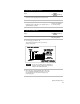
Overview of Grading
Developing a grading plan typically results in the creation of a
proposed surface model. This allows you to analyze a site efficiently
and accurately and to create reports, graphics, and 3D presentation
materials that are necessary for the completion of the project. Using
this finished ground model, you can calculate cut and fill volumes,
determine grading limits, generate proposed grade and cut/fill
contours, calculate the watershed areas for the surface, and create
post-development runoff models.
Finished Ground Data
Whereas an existing ground surface is based on surveyed points and
existing contours, a finished ground surface is based on grading data
that you create. Your goal is to create enough grading data so that this
finished ground surface is as accurate as possible. Grading data can
consist of points, 3D polylines, contours, pond models, daylight lines,
points, and breaklines.
There are many commands in AutoCAD Land Development Desktop
that you can use to create grading data, including points, contours,
and 3D polylines.
Autodesk Civil Design adds the ability to create the following
grading data:
■
Grading objects
■
Daylight lines, points, and breaklines
■
Finished ground labels
■
Pond models that you can use for hydrology calculations
When you have created all of the finished ground grading data, you
can then create the finished ground surface. For more information
about creating surfaces, see Chapter 5, “Working with Surfaces” in the
AutoCAD Land Development Desktop Getting Started Guide.