
Technical data
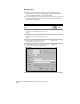

Creating Overlay Topologies
273
Creating Overlay Topologies
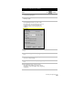
Overlay topologies show how topologies relate to each other. For
example, you can overlay a parcel map topology with a soils map
topology. Then, basing your calculations on soil type, you can
determine the buildable area on each parcel.
An overlay topology includes a source topology and an overlay
topology. The results of the overlay topology depend on which
topology you choose as the source topology. For example, the results
of the Identity, Erase, and Clip operations will vary, based on which
topology you choose as the source and overlay topologies. You can
create several different types of overlay topologies:
■
Intersect: Only the areas that appear in both topologies are saved
to the resulting overlay topology.
■
Union: Areas that appear in either topology are saved to the
resulting overlay topology.
■
Identity: Acts like a union topology. The boundary of the source
topology, however, controls the limits of the resulting topology. If
an item in the overlay topology is outside the boundary of the
source topology, then it is not saved to the resulting overlay
topology.
■
Erase: Erases everything in the source topology covered by the
overlay topology.
■
Clip: The overlay topology acts like a clipping boundary.
Everything in the source topology not covered by the overlay
topology is clipped.
■
Paste: Pastes all areas in the overlay topology into the source
topology.