
Technical data

Performing Zone Conversions Using AutoCAD Map
267
Performing Zone Conversions Using
AutoCAD Map
You may at times receive drawings of the same region that were
created in different coordinate zones. For example, one drawing was
created in NAD83 metric, the other in NAD83 feet. To get both of the
drawings to line up correctly, you can perform a zone conversion by
setting up a Map project, and then specifying the coordinate zones for
the source drawing and the Map project.
Key Concepts
■
This is a quick way to convert zones. However, it is recommended
that you establish one coordinate zone for all the drawings for a
job.
■
Zone conversions respect the base point and north rotation of the
source drawings. As drawing information is extracted from one
drawing through a query and brought into the Map project, its
zone is read and converted to the Map project zone—causing the
data to be displayed in the current zone. When saving data back to
the source drawing, the process is reversed. The data that is saved
back is converted back to the zone of the source drawing.
■
The current zone in AutoCAD Land Development Desktop is used
as the current Map project zone. If you change either the settings
or the zone by using AutoCAD Map commands, then the zone is
updated automatically in AutoCAD Land Development Desktop to
ensure consistency.
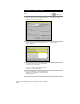
To perform zone conversions
Steps
Use
to look up
1
Create a new drawing. This is your Map project.
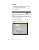
Start a New Drawing
Create a Project
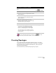
2
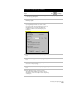
Attach the drawing(s) whose coordinate system
you want to convert.
NOTE The drawings that you are
converting must have previously
been assigned a coordinate zone.