
Technical data

Chapter 8 AutoCAD Map and AutoCAD Land Development Desktop
264
For example, define object data for a parcel map and then create a
report. Paste the report into Microsoft
Access, and then create point
objects in the center of each parcel. You can then use the point labels
to label the points with parcel number, soil type area, and area of
buildable land.
Key Concepts
■
You can assign data to objects as you digitize them or later.
■
Object data tables that you create are stored in the drawing.
However, you can also attach data from an external database. For
more information about attaching data from external databases, see
“Accessing External Databases” in the online Help.
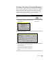
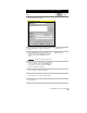
To assign object data to points, lines, arcs, or polylines
Steps
Use
to look up
1
Digitize the lines, arcs, or polylines.
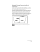
2
From the Map menu, choose Object
Data
➤
Define Object Data to display the Define
Object Data dialog box.
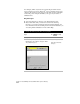
Create an Object Data Table
Define Object Data Table
dialog box