
Technical data

Assigning Data to Objects in a Drawing
263
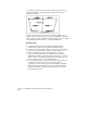
To check the drawing for crossing breaklines (
continued
)
Steps
Use
to look up
10
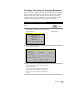
Type
M
to draw markers where the command
found crossing objects.
You can then use the other command line options
to break the objects, examine each crossing
object, and highlight the markers.
For more information about cleaning up maps, use to look up
“About Preparing Maps” in the online Help.
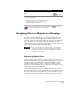
Assigning Data to Objects in a Drawing
In order to use the map analysis tools, you must assign data to the
map objects in your drawing. This data is textual in nature and is
stored in a database table. Tables define the categories of information
that you want to associate with an object. For example, for each
parcel, you may want to know the parcel number, owner’s name and
street address, and percentage of buildable land.
NOTE Before you can assign object data to polygons, you must create
centroids for the polygons. Centroids are points that contain the
object data for the polygons. For more information, see “Creating
Topologies” in this chapter
Exporting Object Data
After you assign data to objects, you can create a report of the object
data. Because the data can be viewed with the Data View window, you
can export, print, or send the data to an OLE-compatible software
program such as Microsoft
Word or Microsoft
Excel for custom
reporting. For more information about Data View, use Find to look up
“About Data View” in the online Help.
Additionally, because the data is in ODBC format, you can paste it
into Microsoft
Access to create an .mdb file. You can import any data
that is in a Microsoft
Access.mdb file as point data. Therefore, you
can bring in any object data that you assign to objects as point data.