
Technical data

Chapter 8 AutoCAD Map and AutoCAD Land Development Desktop
258
To digitize a raster image (
continued
)
Steps
Use
to look up
3
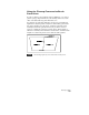
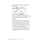
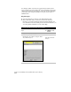
From the Map menu, choose Data
Entry ➤ Digitize Setup.
For digitizing lines, select the Linear option.
For digitizing nodes, select the Nodes option.
Click the Help button in the dialog box for more
detailed information about the settings.
Set Up for Digitizing
Digitize Links and Nodes
4
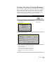
From the Map menu, choose Data
Entry ➤ Digitize.
MAPDIGITIZE
5
Select points (or vertices of polylines if you are
digitizing lines) on the raster image.
6
Continue to select points or vertices until the
image is digitized.
For more information about digitizing maps, use to look up
“About Digitizing and Importing” in the online Help.
Cleaning up Maps
Sometimes when you are digitizing, you may unintentionally digitize
the same object twice. Or you might draw lines that are too long
(overshoots) or too short (undershoots). Before you can create a
topology to perform map analysis, you must perform a map cleanup.
A map cleanup identifies the problem areas in your drawing so you
can go back and fix them. Or, you can choose to have the Cleanup
command fix the problems for you automatically.
Along with deleting duplicate objects and shortening and lengthening
lines, the Cleanup command also locates (and breaks) lines that cross.
This makes digitizing easier, because you do not have to draw discrete
lines for every object that you want to represent, such as parcels.