
Technical data

Digitizing Maps
257
Digitizing Maps
Before you can create a map topology and analyze a map, you must
create the underlying map geometry if it doesn’t already exist. To do
this, use the Digitize command. Digitizing is the process of creating
vector lines by tracing non-vector geometry. The geometry can be
supplied in the form of a paper map that you trace using a tablet and a
digitizer puck, or in the form of a raster image, such as an aerial photo
of a parcel map or a government soils map.
You are not confined to using the Digitize command to create vectors.
You can use the LINE or PLINE commands. However, by using the
Digitize command, you can attach object data to the objects as you
draw them. For more information, see “Assigning Data to Objects in a
Drawing” in this chapter.
For more information about other methods of digitizing, see
“Digitizing” in Chapter 4, “Working with Drawing and Editing Tools”
in this guide.
Key Concepts
■
The Digitize command creates 2D or 3D polylines for soil lines,
streams, power/utility lines, and so on.
■
If you are digitizing contours, then you may want to use the
Digitize Contours command from the Terrain
➤
Contour Utilities
menu. This command creates contour objects at elevations.
■
Use the AutoCAD TABLET command to calibrate your tablet for
digitizing. For more information about tablets, use the Find tab to
look up “TABLET Command” in the online Help.
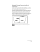
To digitize a raster image
Steps
Use
to look up
1
Create a new drawing.
Start a New Drawing
2
Insert a raster image into the drawing. For more
information see “Inserting Geo-referenced
Images” in this chapter.
Insert Images
NOTE For digitizing purposes, binary
(2-color) images are easiest to use.