
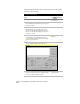
Technical data

Inserting Geo-Referenced Images
255
To insert a Geo-TIFF image into a drawing
Steps
Use
to look up
1
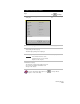
From the Map menu, click Image ➤ Insert to
display the Insert Image dialog box.
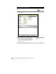
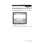
Insert Image dialog box
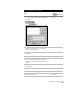
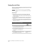
2
Locate the file you want to insert, and verify that
the Modify Correlation check box is selected, as
shown in the following illustration.
In this example, the image that is selected is a GeoTIFF,
an image that has correlation data stored within the
image file.