
Technical data

Chapter 8 AutoCAD Map and AutoCAD Land Development Desktop
248
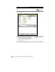
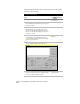
You can now create a query to bring objects from the attached
drawings into the Map project. For more information, see “Defining
Queries” in this chapter.
For more information about Map projects, use to look up “About
Projects” in the online Help.
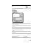
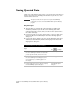
Defining Queries
A query is a retrieval method. You define what you want to bring into
a Map project, and the query brings that data into the drawing from
other drawings or databases. For example, to work in more than one
drawing at a time, you create a Map project, attach the drawings, and
then perform queries. You perform queries when you want to
combine information from two or more drawings, create thematic
maps, and perform zone conversions.
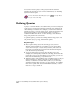
To perform queries, you must be working within a Map project. You
can perform object, topology, and thematic queries.
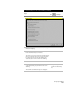
Key Concepts
■
Object queries bring objects into the Map project, based on
different selection methods. For example, you can query either
objects from one layer or objects that you select, such as the soil
lines from one drawing and contours from another drawing into
your subdivision layout drawing.
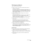
■
Topology queries bring topologies into the Map project. For
example, one drawing may contain the soils map, and another the
parcel map topology. By performing a topology query, you can see
what areas are affected by poorly drained soil.
■
Thematic queries create thematic maps. A thematic map is a map in
which continuous or discrete categories of data are hatched or
shaded, or otherwise associated with a symbol, so you can easily
determine visually what categories you are looking at. For example,
these can be parcels that are below minimum standards, or areas
that are too steep to build on.