
Technical data

Chapter 3 Working with COGO Points
116
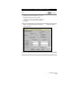
Whenever you want to change the drawing so that it matches the
project point database, or if you want to change project points to
match the drawing, you can use the Check Points commands on the
Points menu. These commands are invaluable for managing the
project point database and drawing points. You can use these
commands to
Add project points to the
drawing.
Add drawing points to the
project.
Remove drawing points
from the project.
Remove project points from
the drawing.
■
Modify drawing points to
match the project.
Modify project points to match
the drawing.
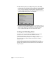
Performing Geodetic Transformations
on Points
AutoCAD Land Development Desktop has geodesy commands that
you can use to relate survey data to mathematical models of the earth.
Using the geodesy commands you can
■
Calculate the latitude and longitude, State Plane, or UTM
coordinates of a point.
■
Convert point data that is in another coordinate zone into the
current drawing’s coordinate zone when you import points.
■
Convert point data in your project from one coordinate system to
another.
You can choose the current zone from over 350 different zones. These
zones include UTM projections, and NAD27 and NAD83 State Plane
grids. Commands are also provided for you to edit zones and create
new zones.
You can use geodetic calculations, related to the current zone,
whenever you have any high-order survey calculations to complete, or
if you must tie a survey into either state plane coordinates or UTM
map projections.
You can also set the transformation settings for the whole drawing.
These relate the assumed local northing/easting coordinates of your
survey to the selected current zone.