
Technical data

Working with Points
107
Coordinate Zone Transformations
You can perform coordinate zone transformations while importing
points. For example, if you import points based on lat/longs into a
drawing that uses a UTM zone, then you can specify which zone the
points are being imported from. When the points are imported, they
are converted to the drawing’s coordinate zone. For more information
about performing coordinate zone transformations see “Performing
Geodetic Transformations on Points” in this chapter.
To create an import/export format and import points
Steps
Use
to look up
1
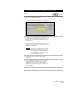
From the Points menu, choose Import/Export
Points ➤ Format Manager to display the Format
Manager dialog box.
Create a Point
Import/Export Format
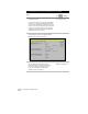
Several default import/export formats are available
for you to use. You can select one and click View to
see how the format is set up