
Technical data


Chapter 3 Working with COGO Points
100
Working with the Project Point Database
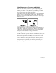
AutoCAD Land Development Desktop uses a project point database to
store the point information for a project. This file is named
points.mdb and is stored in the project’s \cogo folder.
(For example, c:\Land Projects R2\newproj\cogo\points.mdb.)
You are prompted to set up this point database whenever you start a
new project.
The AutoCAD Land Development Desktop Points commands, and
any Autodesk Civil Design or Autodesk Survey commands that
create points, add the points to the point database. If you use
Autodesk Survey to import a fieldbook file, then the point data is
added to the point database and the observation data is added to
the observation database.
This point database is important because:
■
All programs in the Land Development Solutions suite—
AutoCAD Land Development Desktop, Autodesk Survey, and
Autodesk Civil Design—use it.
■
You can set it up so that multiple people can access it over a
network.
■
It stores all the point information outside the drawing and keeps
drawing size small.
Because all the point information for a project is stored in this one
file, it is much easier to manage the point data for a project. This is
especially true when you work on a large project that contains several
different drawings or when you work on the same project with other
people over a network.
All commands that use point data, such as when you draw a line
between points, refer to the point database, not to the drawing.
Therefore, you can perform these functions even when the points are
not drafted in your drawing. This gives you added flexibility when
you work on large projects with thousands of points. By keeping the
points out of the drawing, you can speed up screen redraw time
significantly.