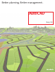
Better planning. Better management.
Access Granted Find out why so many CAD software users are switching to AutoCAD Map 3D software—A better AutoCAD software for planning and managing infrastructure. Used Around the World Utilities and Telecommunications • Los Angeles Department of Water and Power • Tokyo Electric Power Services Co.
Effectively Utilize Spatial Data With powerful, open-source FDO technology, AutoCAD Map 3D can provide access to data previously locked up in the GIS department and provides state-of-the-art tools to edit native geospatial data. Powerful Mapping and Visualization Tools Use Map 3D to visualize and evaluate vector, raster, and tabular data in a variety of formats.
Using AutoCAD Map 3D, we exploited our AutoCAD skills to tap quickly into ESRI maps, utility data, property data, and more without having to use ESRI software. AutoCAD Map 3D gave us the GIS tools we needed, but allowed us to use our AutoCAD expertise, reducing training time and expenses.