
Technical information

76 | Chapter 4 Working with Surfaces
You can use AutoCAD Land Desktop to create existing ground or finished
ground contours. To create contours, you can
Note You can use contours to represent features other than elevations.
For example, contours can represent rainfall intensity, soil contamination lines,
and so on.
Creating Contours from a Surface
As you create contours from a surface, use a contour style that controls how
the contour and contour labels display. For example, a contour style controls
■ smoothing
■ grip display (for editing contours and contour labels)
■ label text style
■ label position
When you create contours, you must choose a style. You can also specify
elevation ranges, contour intervals, and whether to create the contours as
AEC contour objects or polylines. All contour definition, editing, and label-
ing commands work on both contour objects and polylines.
Note To edit AEC contour objects in another AutoCAD program (other than
AutoCAD Land Desktop), you must explode the contour objects because they
are custom objects. Or, you can install the Object Enabler, which is available on
the AutoCAD Land Desktop product media.
When you create contours from a surface, you base the contours on a
contour style. Use the Contour Style Manager to define and modify
contour styles.
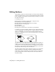
■ Generate contours from the current
surface model.
■ Convert polylines to contours.
■ Vectorize contours on a raster image. ■ Digitize a paper contour map.
■ Copy contours. ■ Offset contours.