
Technical information


63
4
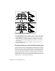
Working with Surfaces
You can use points, DEM files (digital elevation models),
contours, breaklines, and boundaries to generate a
model of the earth’s surface. From this model, you can
create contours and sections, and by comparing two
surfaces, you can calculate volumes.
In this chapter
■ Working with the
Terrain Model Explorer
■ Creating surface data
■ Building surfaces
■ Calculating finished ground data
■ Editing surfaces
■ Working with surface output
and visualization tools
■ Creating contours
■ Calculating volumes