
Technical information


60 | Chapter 3 Working with COGO Points
5 Enter the latitude and longitude of the first point that you
observed with the GPS. The calculator automatically
displays the grid northing and grid easting coordinates for
the point that is related to the current zone that you
selected in step 2. Make a note of these coordinates.
6 Enter the latitude and longitude of the second point that
you collected and make a note of the grid northing and
grid easting coordinates.
You can now use these grid northing and easting
coordinates to set the transformation settings for
the drawing.
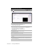
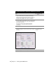
7 Click OK to close the Geodetic Calculator dialog box.
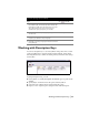
8 From the Projects menu choose Transformation
Settings to display the Geodetic Transformation Settings
dialog box.
Changing the Geodetic
Zone Transformation
Settings
9 Select the Apply Transform Settings check box.
To calculate State Plane coordinates from GPS data (continued)
Steps
Use to locate