
Technical information


58 | Chapter 3 Working with COGO Points
Hundreds of different zones are provided in AutoCAD Land Desktop, includ-
ing UTM projections, and NAD27 and NAD83 State Plane grids. You can also
use commands to edit zones and create new zones.
You can use geodetic calculations, related to the current zone, whenever you
have any high-order survey calculations to complete, or if you must tie a
survey into either state plane coordinates or UTM map projections.
To relate the assumed local northing/easting coordinates of a survey to the
selected current zone, you must set the Transformation Settings for the
drawing.
Key Concepts
■ The State Plane coordinates are expressed as grid northing and grid easting
coordinates.
■ The assumed coordinates, local northing and local easting coordinates,
are equivalent to the COGO point coordinates in the point database.
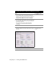
■ The Geodetic Calculator supplies “missing” information related to the
current zone. For example, if you know the latitude and longitude of a
point, then you can enter this information into the calculator to compute
the grid northing/easting coordinates. You can then use this information
to set the Transformation Settings for the drawing.
■ After you set the Transformation Settings for a drawing, you can enter the
local northing/easting coordinates into the Geodetic Calculator to com-
pute either the grid coordinates or latitude and longitude of any point.
Calculating State Plane Coordinates from a
Known Latitude and Longitude
You can use the Geodetic Calculator to relate local northing and easting coor-
dinates to a State Plane coordinate system by using a known latitude and
longitude that you collect using a Global Positioning System (GPS) receiver.
After you calculate the grid coordinates, you can set the transformation set-
tings for the drawing. This lets you calculate the grid coordinates or latitude
and longitude of any point in the survey.