
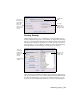
Technical information

24 | Chapter 2 Getting Started with AutoCAD Land Desktop
and the following civil engineering features
■ Sheet Manager label and grid styles
Using the World Coordinate System
for Creating Data
When you use a default drawing template to start a new drawing in AutoCAD
Land Desktop, you are in the world coordinate system (WCS) automatically.
The X axis is horizontal, the Y axis is vertical, and the Z axis is perpendicular
to the XY plane.
Warning! If you create data with AutoCAD Land Desktop, it is very important
that the coordinate system be set to World. If you create data in AutoCAD Land
Desktop in a coordinate system other than World, that data is not processed cor-
rectly.
To change the coordinate system to World, type UCS on the command line,
and then type World.
Working with Projects
Each AutoCAD Land Desktop drawing must be associated with a project. This
section describes in detail the function of projects and how to manage them.
■ To work with AutoCAD Land Desktop commands, you must have a
project. You can, however, run AutoCAD or AutoCAD Map 3D commands
without having a project selected.
■ You can assign a drawing to only one project. If you want to later associate
the drawing with a different project, you can re-associate the drawing by
using the Reassociate Drawing command from the Projects menu.
■ Projects can contain multiple drawings. All the drawings in a project share
data files, such as the point database.
■ If you open an existing drawing that is not assigned to a project, then you
are prompted to select a project. This assignment is saved when you save
the drawing.
Creating Projects
You can create a new project when you create a new drawing, or you can
create a new project from the Project Manager. As you create a new project,