
Technical information

Creating Surfaces and 3D Data from Road Design Data | 187
Creating Surfaces and 3D Data from Road
Design Data
You can use the Road Output commands on the Cross Section menu to sim-
plify the process of creating surfaces and other 3D data from finished ground
road designs.
Use the Create Road Surface command to create surface data from a road
design. You can either create a new surface from the data or add the data to
an existing surface.
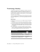
5 In the Superelevation Control dialog box, click OK to
display the Save Status dialog box, and then click Yes to
apply superelevation parameters to all existing cross
sections. The Superelevation Section Sampling dialog box
is displayed.
6 In the Superelevation Section Sampling dialog box, you
can choose to sample sections at key superelevation
stations. Select the Sample These Stations check box, set
the swath widths, select the surface(s) to sample, and click
OK.
Adding Sampled Cross
Sections to Key
Superelevation Stations
7 To view and modify the superelevation at individual cross
section, from the Cross Sections menu, choose View/Edit
Sections.
Editing the Superelevation
8 Although profiles do not support superelevation directly,
you can convert the superelevation information to a
transition to import it into the profile.
From the Cross Sections menu, choose Templates
➤ Edit
Template to define transition points at the same location
as the superelevation points on the template. From the
Cross Sections menu, choose Ditch/Transition
➤ Import
Profile to import superelevation as a transition line into the
profile.
Importing Superelevation
into a Profile
To superelevate a roadway (continued)
Steps Use to locate