
Technical information

186 | Chapter 13 Viewing and Editing Roads in Section View
Superelevating a Roadway
Superelevation occurs on roadways where the horizontal alignment curves
and the road must bank to accommodate the speeds of automobiles. As a car
approaches a curve, the roadway cross slope changes until the roadway
reaches a full superelevated state, and then the cross slope returns to normal
as the car exits the curve.
To define superelevation for roads, define superelevation regions on a road-
way template. You can also use the Superelevation Parameters command to
modify the design control for superelevation. To modify superelevation one
cross section at a time, you can use the View/Edit Sections command.
Key Concepts
■ To apply superelevation to cross sections, you must use the Edit Template
command to place superelevation control points on the roadway surface
template.
■ To add sampled cross sections at key superelevation stations, you must
sample cross sections prior to applying superelevation, apply supereleva-
tion parameters, and then use the Superelevation Section Sampling dialog
box.
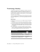
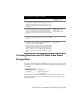
To superelevate a roadway
Steps Use to locate
1 From the Cross Sections menu, choose Templates
➤ Edit
Template to define the superelevation regions on the
finished ground template.
Defining the Template
Superelevation Regions
2 To apply the template to the cross sections, from the
Cross Sections menu, choose Design Control
➤ Edit
Design Control, and then click Template Control.
Specifying the Design
Control Values for
Templates
3 To modify the superelevation curve parameters, from the
Cross Sections menu, choose Design
Control
➤ Superelevation Parameters.
In the Superelevation Control dialog box, you can select a
method of superelevation to use, change the subgrade
superelevation values, and so on.
Changing the
Superelevation Control
Values
Editing, Inserting, or
Deleting a Superelevated
Curve
4 You can generate a report of cross section information by
clicking Output in the Superelevation Control dialog box.
Outputting the
Superelevation Data