
Technical information


170 | Chapter 13 Viewing and Editing Roads in Section View
Viewing and Editing Roads in Section View
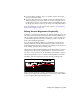
After you have created a roadway alignment and profile, you can generate
cross sections. Cross sections are cut at specific stations along an alignment.
When you use the Cross Sections commands, you can
■ Create existing ground cross sections for the alignment
■ Create finished ground roadway surface templates
■ Establish design parameters for ditches, superelevation, and transitions
■ Extract, view, modify, and plot cross sections
■ Insert cross sections in a drawing for plotting
■ Output volumes using Average End Area or Prismoidal methods
■ Place design roadway points in a drawing or external file for field staking
■ Create a surface or other 3D data from a finished ground road design
■ Create a 3D road grid of the alignment
The following is a brief summary of the design process for alignment
cross sections:
Design process for creating a cross section for an alignment
Step Description
Creating existing ground data
■ Sample the data from one or more surfaces.
■ Import the data from a text file.
■ Enter the data into the Existing Ground Section
Editor.
Creating existing ground
subsurfaces (optional)
■ You can create them at the same time as the top
surface by sampling multiple surfaces or by
sampling them from a text file.
■ If you create cross sections from a single existing
surface, then you can define the subsurfaces later
by entering borehole data with Interpolation
Control in the Existing Ground Section Editor.