
Technical information


162 | Chapter 12 Viewing and Editing Roads in Profile View
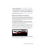
Superimposing Vertical Alignment Data
You can use the Utilities ➤ Superimpose Profiles command to plot the
elevations from one vertical alignment onto the profile of another adjacent
alignment.
The program reads the elevations and stations of the source vertical align-
ment you select and finds the corresponding offset station from the destina-
tion alignment. The program then plots the resulting elevations as a polyline
on the destination profile. You can use the vertical alignment information to
perform various tasks, such as define the lines as a vertical transition profile
to control template transition elevations, or use as a reference or representa-
tion for a design.
5 From the Profiles menu, choose FG Vertical
Alignment
➤ Define FG Centerline to define the finished
ground centerline.
When you select this command, all layers, other than the
FG Centerline layer, are turned off so you can quickly
select only the FG Centerline objects.
Defining the Finished
Ground Centerline as a
Vertical Alignment
To create a finished ground profile centerline (continued)
Steps Use to locate