
Technical information


160 | Chapter 12 Viewing and Editing Roads in Profile View
When you generate a profile, you can do the following:
■ Import the left and right profiles (if you sampled left and right offsets for
the existing ground).
■ Specify the station range and datum elevation for the profile.
■ Control whether the profile is created from left to right, or from right
to left.
■ Control whether a grid is inserted with the profile.
NOTE By specifying the station range, you can import a subset of the entire
profile. When you define the finished ground profile definition, you should
work with the entire length of the profile. A subset of the entire profile should
be imported only for plotting purposes.
To create an existing ground profile
Steps Use to locate
1 From the Alignments menu, choose Set Current
Alignment to make sure that the proper alignment is set
as current.
Making an Alignment
Current
2 Sample the existing ground data (either from a terrain
model surface, an ASCII text file, or manual input) by
using one of the commands in the Profiles
➤ Existing
Ground menu.
Sampling the Existing
Ground Profile Data from a
Surface
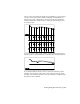
3 From the Profiles menu, choose Create Profile
➤ Full
Profile to draft the profile. In the Profile Generator dialog
box, you can select to draw the profile from left to right
or from right to left. You can also control the profile
datum, scale, and use of a grid.
You can draw the entire profile at one time or you can
import stages of the alignment.
Creating a Complete Profile