
Technical information


158 | Chapter 12 Viewing and Editing Roads in Profile View
surfaces, you must first create a file of the surface names using the Select
Multiple Surfaces command. Then, before sampling the data, enable the
multiple surfaces by selecting Toggle Multiple Surfaces. The Sample From
Surface command accesses the files that were created when you originally
generated the surface, and then creates a file containing existing ground
elevations along the defined alignment. You can use the existing ground
elevations to create an existing ground profile.
The Sample From Surface command processes the profile information for a
specified station range and displays the distance sampled in a statement
similar to the following:
You have sampled profile for 3856.25 feet of alignment
The command creates a file for the current alignment with a .vrt extension in
the following folder:
c:\Land Projects <Version Number>\<project name>\align\ <alignment name>
If a file with the same name already exists, then the command displays a
confirmation prompt to overwrite the previous definition.
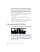
Creating Existing Ground Profiles
You can create an existing ground profile in a drawing, and then add finished
ground roadway design geometry to represent the roadway in profile view.
Before you create a profile, configure the profile settings. For more informa-
tion, see “Changing the Profile Settings” on page 157. When you create a
profile, an invisible block is inserted at the profile insertion point. This block
contains information specific to that particular plot of the profile, including
its location in the drawing, the vertical exaggeration, and the layer settings.
This block also contains the Values settings for the profile; therefore, you
must configure the settings before you use the Full Profile, Surface Profile, or
Quick Profile commands.