
Technical information


Importing LandXML Data | 115
Importing LandXML Data
Use the LandXML Import command to import the following data into the
current AutoCAD Land Desktop project:
■ COGO points
■ Point groups
■ Description keys
■ Surfaces
■ Parcels
■ Alignments
■ Profiles
Note The LandXML Import command does not support cross sections or pipe
data.
Key Concepts
■ You can specify the data to import in two phases. First, in the LandXML
Import dialog box, specify the general data types to import, such as points.
Then, in the LandXML Import Selection dialog box, use the options to
specify exactly the points (or other data) to import.
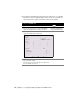
5 To specify the location and detail of the exported file, the
default schema location, and to select an XSL style sheet
to apply to the data, click File under Export Options.
NOTE You can use Autodesk LandXML Reporting, a
stand-alone application that is installed when you install
AutoCAD Land Desktop, to produce reports from
LandXML data.
Changing LandXML Export
File Options
6 Click Export, specify a file name, and click Save to export
the data.
As the data is exported, the export progress is indicated
on status bar at the bottom of the LandXML Export dialog
box.
To export data in LandXML format (continued)
Steps
Use to locate