
Technical information


Working with Parcels | 93
After you define a parcel, you can calculate its earthwork volumes using the
grid and composite volume methods. For more information about earth-
work, see “Calculating Volumes” on page 79.
You can use the AutoCAD Map 3D commands to create a database of parcel
numbers, owners, cost, and so on to help manage parcel maps.
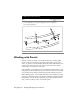
Drawing Parcel Geometry
To draw the parcel boundaries, you can use the commands from the Lines/
Curves menu, or other AutoCAD commands such as LINE or PLINE. You can
also define parcel boundaries from points.
Note Do not use spirals in parcel boundaries. Spirals cause incorrect areas to
be reported.
You can also use Survey to draw parcel boundaries as Survey Figures. You can
use the Survey Command Language to input the data in a data collector, or
you can input the data using the Survey command line.
Note Be sure to draw the parcels as closed regions. If any of the joining lines
has a break, then you cannot calculate areas.
If you use polylines to draw parcel geometry, then you must break crossing
polylines before defining the parcels. Also, delete any duplicate lines that you
may have drawn where two parcels abut each other. You can break crossing
lines and erase duplicate lines by using the AutoCAD Map 3D Cleanup
command.
Draw Parcel Geometry Based on Area
To draw a parcel as an exact area, use the Parcel Sizing commands. Draw the
parcel with only one open segment, and then use one of the Parcel Sizing
commands to close the segment. Parcel Sizing commands include Slide
Bearing, Radial, Swing on Line, and Swing on Curve.