
Technical data


36 Post-Process GPS Surveying
the integer ambiguities. Once the integer ambiguities have been calculated, your
current location can be determined very precisely. Solving for the integer
ambiguities is the most time consuming part of GPS data collection. Once solved,
the position of your currently location is instantly known. In addition, once you have
calculated the integer ambiguities, they stay fixed as long as you maintain lock on
at least five satellites. If you happen to lose lock on satellites due to an obstruction,
and go below the five-satellite threshold, the integer ambiguities will be lost and
must be calculated again, i.e. you must initialize your kinematic survey again. All
data collected prior to losing the initialization is not affected by your loss of
initialization.
From the point of initialization forward (until initialization is lost), the rover system
is continually computing positions at the 0.03 – 0.05 meter (0.10 – 0.15 ft) level.
So, if you set your recording interval to 2 seconds, as you walk around the project
site, every two seconds you are recording your position to this level of precision. If
you stop in one location and observe for 8 seconds or more, your precision will
improve to 0.01 – 0.03 meters (0.03 – 0.10 ft).
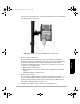
Initialization of your kinematic survey can be accomplished in several ways.
1. Initialize by performing a static survey
Initialization of your kinematic survey can be accomplished by performing a
static survey. This is the most time consuming method of initializing a
kinematic survey, requiring an observation time of 5 minutes or more
depending on the distance between the base and rover systems.
Following is a scenario where this type of initialization would be used.
You arrive on a new project site where you need to perform a kinematic
survey. There are no known points in the vicinity so you must perform a static
survey in order to initialize your kinematic survey. You set up the base station
on an existing point with known coordinates or an arbitrary point where
approximately coordinates will be assigned. You assign a point ID of 0001 to
your base point. You drive a PK into the ground, approximately 10 feet from
the base point, to mark your initialization point. You assign a point ID of 0100
to your initialization point. You set your rover system up over this PK, enter
the point ID, and observe this point for 5 minutes. This is sufficient data to
statically position this location. You are now initialized. You can pick up your
rover system and begin positioning other points.
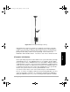
2. Initialize on a known point
Initialization of your kinematic survey can be accomplished by collecting a
short amount of data on a point whose position is very well known with
reference to the location of the kinematic base station. This is the quickest
method for kinematic initialization, requiring approximately 10 seconds of
observation time on the known point.
Following is a scenario where this type of initialization would be used:
630045.book Page 36 Sunday, February 11, 2001 11:38 AM