
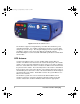
Technical data


4 Post-Process GPS Surveying
Static data collection produces the most accurate and reliable results due to the
amount of data collected during each observation. The disadvantage is in
productivity. Long observations at each point reduce the number of points that
canbecollectedinaday.
Kinematic Data Collection
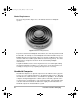
With kinematic data collection, one of the GPS receivers in the system is
designated as the base and remains stationary throughout the survey. All
surveyed points are determined relative to the base. Once operational, the base
system simply collects and stores raw data from all the available satellites.
The other GPS receiver(s) is designated as the rover. Again, as the name
implies, kinematic data collection is dynamic in nature. The operator of the rover
system moves around the project site collecting data on items of interest. While
moving around the project site, the operator will stop for a short period of time to
position a specific item, such as a manhole. Occupation time of the point can
range from 6 seconds to 60 seconds. Once finished, the operator moves on the
next point. Also, the operator can position linear features, such as the centerline
of a road, by simply walking along the centerline and instructing the rover system
to store a position every five seconds, for example. The result is a trail of points
defining the centerline.
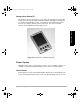
To facilitate the mobility required to utilize the kinematic method of data collection,
the rover system is designed to be man-portable, usually carried in a backpack.
The user interfaces with the rover system through a handheld computer/data
collector.
While it is obvious that kinematic data collection has the advantage of high
productivity, there are disadvantages. Accuracies are not as good as with static
data collection. In addition, the rover system must maintain lock on GPS
satellites as it moves around the project area. Loss of lock requires the user to
return to one of the last successfully established points for initialization.
Post-process Data Processing
Post-process GPS surveying requires that collected GPS data be later processed
to obtain results. Processing is accomplished by software included with the
system. Processing normally occurs on a PC back at the office, but can also be
performed on a laptop in the field.
To accomplish the post-processing, data is downloaded from each GPS receiver
into the computer. The processing software utilizes this data to calculate vectors
between all GPS receivers operating simultaneously. The vectors define the 3-
dimensional relationship between the GPS receivers. From these vectors,
coordinates are determined for all points in the project, based on the coordinates
630045.book Page 4 Sunday, February 11, 2001 11:38 AM