
User`s manual
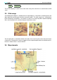
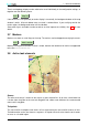
Table Of Contents
- Introduction
- User Interface
- Display Elements
- Cross Country Tasks
- Glide Computer
- Atmosphere and Instruments
- Airspace, Traffic and Team Flying
- Avionics and Airframe
- Quickstart
- InfoBox Reference
- Configuration
- Data Files
- About XCSoar
- GNU General Public License
3 DISPLAY ELEMENTS
The moving map shows:
• Waypoints
• Terrain and topology
• Markers
The map is drawn in a projected coordinate system (not latitude and longitude), and the scale can
be changed (zooming in and out), as well as panned. All navigation functions take the curvature of
the Earth into account.
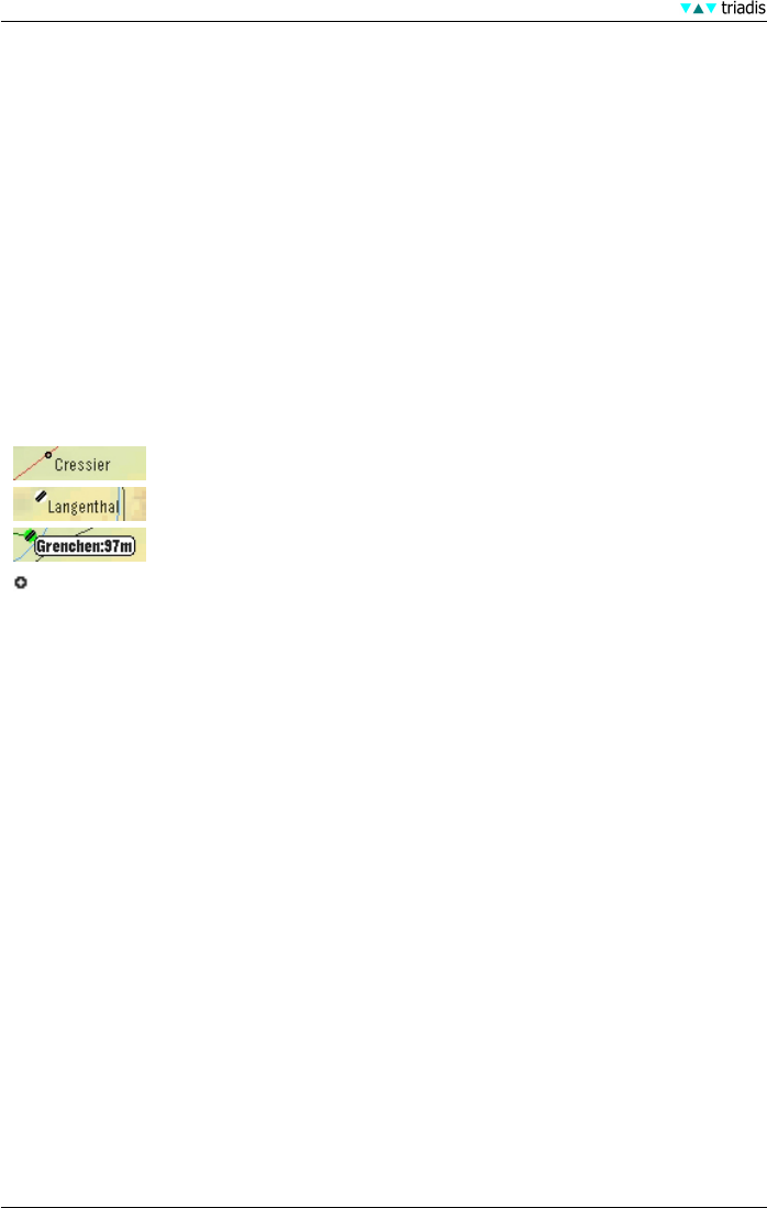
Waypoints
Waypoints are displayed with different symbols depending on the waypoint type; the major distinc-
tion being landable and non-landable waypoints.
triadis engineering GmbH recommends the option ‘Alternative’ for waypoint display (see 11.11).
With this option, the waypoint symbols are drawn as shown below:
Non-landable waypoints: small black hollow circles.
Unreachable airfields: white with a grey diagonal band.
Reachable airfields: green with a grey diagonal band.
At large zoom scales, all waypoints are drawn as small black crosses.
Waypoints are optionally labelled according to one of several abbreviation schemes.
XCSoar continually calculates which landing points are within gliding range using the current wind
estimate. The estimated arrival altitude above the arrival safety height of reachable landable points
is optionally displayed next to the waypoint (see 11.3 for these configuration options). This arrival
altitude is calculated at the MacCready setting of zero.
Terrain and topology
The following topological features are drawn on the map:
• Major roads, shown as red lines
• Railway lines, shown as black lines
• Rivers, shown as blue lines
• Large water bodies (lakes), shown as blue areas
• Large cities, shown as yellow areas
Terrain is coloured according to height, and optionally shaded by sun direction or lift-generating
slope. Invalid terrain, or terrain below sea level is coloured blue.
Terrain is phong-shaded to improve visibility. Currently the shading is set up so that the virtual
lighting position is the wind bearing, thus brighter areas are on the upwind side of hills and dark
areas in the lee of the hill. The amount of phong shading and the overall terrain brightness are
configurable (see 11.4). Support for a sun ephemeris is underway.
25 XCSoar Manual (Altair version) • XCSoar-A-EN