
User`s manual

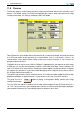


Table Of Contents
- Introduction
- User Interface
- Display Elements
- Cross Country Tasks
- Glide Computer
- Atmosphere and Instruments
- Airspace, Traffic and Team Flying
- Avionics and Airframe
- Quickstart
- InfoBox Reference
- Configuration
- Data Files
- About XCSoar
- GNU General Public License

12 DATA FILES
Several commercial and freely distributable programs exist for converting between different way-
point formats.
If the elevation of any waypoints is set to zero in the waypoint file, then XCSoar estimates the
waypoint elevation from the terrain database if available.
Furthermore, if the terrain database is available, then waypoints outside the terrain coverage area
cause a dialog to open asking the user if these waypoints are individually or all to be ignored
(excluded) or loaded (included). The configuration setting ‘Wpt outside terrain’ can be used to ask,
exclude or include all waypoints outside terrain on subsequent loads.
12.5 Airspace
XCSoar supports airspace files (extension .txt) using a subset of the widely distributed OpenAir
format. Files are available from the Special Use Airspace section of the Soaring Server at http:
//soaringweb.org/SUA.
The following are the list of supported airspace types: Class A, Class B, Class C, Class D, Class
E, Class F, Prohibited areas, Danger areas, Restricted Areas, CTR, No Gliders, Wave, Other. All
other airspace types will be drawn as type “Other”.
12.6 Map
The map file (extension .xcm) contains terrain, topology and optionally waypoints and airspace
information. The use of map files reduces the number of files the user needs to manage and to
specify in the configuration settings. For backward compatibility, though, the previous methods of
using individual terrain, topology, and waypoint files has been retained.
Map files can be generated from the online terrain/map file generator available from the xcsoar
website. This allows users to generate their own map files for their region, incorporating their own
waypoint files or by specifying the bounds of the region of interest.
Map files are superior to individual terrain/topology files because they incorporate compression of
the data, thereby allowing much larger areas and higher resolution terrain to be used.
12.7 Airfield details
The airfield details file (extension .txt) is a simple text format file containing entries for each air-
field, marked in square brackets in uppercase, followed by the text to be displayed on the Waypoint
Details Dialog for that particular waypoint. The text should have a narrow margin because the
waypoint details dialog cannot currently handle word wrapping.
The names of airfields used in the file must correspond exactly to the names in the waypoints file,
with the exception of being converted to uppercase.
The XCSoar website provides airfield details files for several countries and includes tools to convert
from various Enroute Supplement sources to this file format.
Users are free to edit these files to add their own notes for airfields that may not otherwise be
included in the Enroute Supplement sources.
An example (extract from the Australian airfields file):
[BENALLA]
RUNWAYS:
XCSoar Manual (Altair version) • XCSoar-A-EN 112