
User`s manual

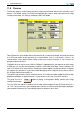
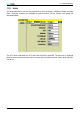
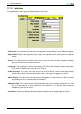
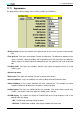

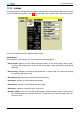

Table Of Contents
- Introduction
- User Interface
- Display Elements
- Cross Country Tasks
- Glide Computer
- Atmosphere and Instruments
- Airspace, Traffic and Team Flying
- Avionics and Airframe
- Quickstart
- InfoBox Reference
- Configuration
- Data Files
- About XCSoar
- GNU General Public License

12 DATA FILES
12 Data Files
Data files used by XCSoar fall into two categories:
• Flight data files These files contain data relating to the aircraft type, airspace and maps, way-
points etc.
• Program data files These files contain data relating to the ‘look and feel’ of the program, includ-
ing language translations, button assignments, input events, dialog layouts.
This section focuses on flight data files; see the XCSoar Advanced Configuration Guide for details
on program data files.
12.1 File management
File names must correspond to the name extensions specified below. It is good practice to make
sure that the file names are recognisable so that when making configuration changes there is less
risk of confusion between different files and different file types.
All data files should be copied into the directory:
My Documents/XCSoarData
12.2 Terrain
The terrain file (extension .dat) is a raster digital elevation model represented as an array of
elevations in meters on a latitude/longitude grid. The format used is unique to XCSoar as it contains
a header containing the grid geometry followed by the raster array.
Terrain files for various regions can be obtained from the XCSoar website. Additional terrain files
can be produced upon request.
12.3 Topology
The topology file (extension .tpl) is a text file containing a series of entries each of which de-
fine a layer of topology. Typical layers include roads, railway lines, large built-up areas (cities),
miscellaneous populated areas (towns and villages), lakes and rivers.
The topology file defines which features are to be displayed, their colour, maximum zoom visibility,
icons, and labelling. This file can be customised, for example to add or remove specific layers. The
topology data itself uses ESRI Shape files which are generated from the freely available VMAP0
database.
Topology files for various regions can be obtained from the XCSoar website. Additional topology
files can be produced upon request.
12.4 Waypoints
XCSoar uses waypoint files written in the format designed by Cambridge Aero Instruments for their
C302 instrument. The file extension should be .dat.
Files are available from the Soaring Turn-points section of the Soaring Server http://soaringweb.
org/TP.
111 XCSoar Manual (Altair version) • XCSoar-A-EN