
User`s manual
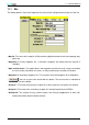
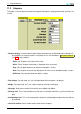
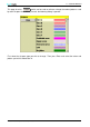
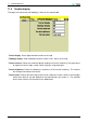
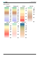


Table Of Contents
- Introduction
- User Interface
- Display Elements
- Cross Country Tasks
- Glide Computer
- Atmosphere and Instruments
- Airspace, Traffic and Team Flying
- Avionics and Airframe
- Quickstart
- InfoBox Reference
- Configuration
- Data Files
- About XCSoar
- GNU General Public License
11 CONFIGURATION
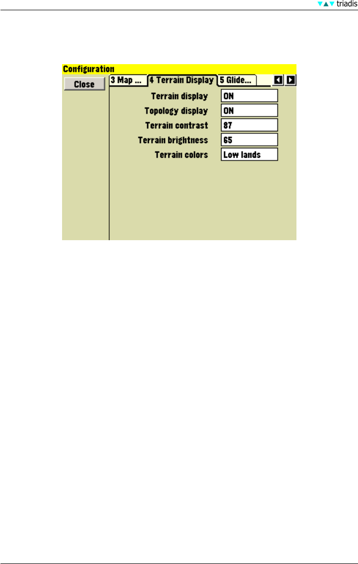
11.4 Terrain display
This page sets how terrain and topology is drawn on the map window.
• Terrain display Draws digital elevation terrain on the map
• Topology display Draws topological features (roads, rivers, lakes) on the map
• Terrain contrast Defines the amount of phong shading in the terrain rendering. Use large values
to emphasise terrain slope, smaller values if flying in steep mountains.
• Terrain brightness Defines the brightness (whiteness) of the terrain rendering. This controls
the average illumination of the terrain.
• Terrain colors Defines the color ramp used in terrain rendering. Various schemes are available,
which works best for you will depend on how mountainous your region is. The available
terrain color schemes are illustrated in the table below.
99 XCSoar Manual (Altair version) • XCSoar-A-EN