
User`s manual
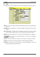
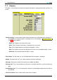
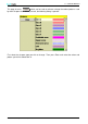
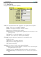
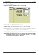


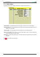
Table Of Contents
- Introduction
- User Interface
- Display Elements
- Cross Country Tasks
- Glide Computer
- Atmosphere and Instruments
- Airspace, Traffic and Team Flying
- Avionics and Airframe
- Quickstart
- InfoBox Reference
- Configuration
- Data Files
- About XCSoar
- GNU General Public License
11 CONFIGURATION
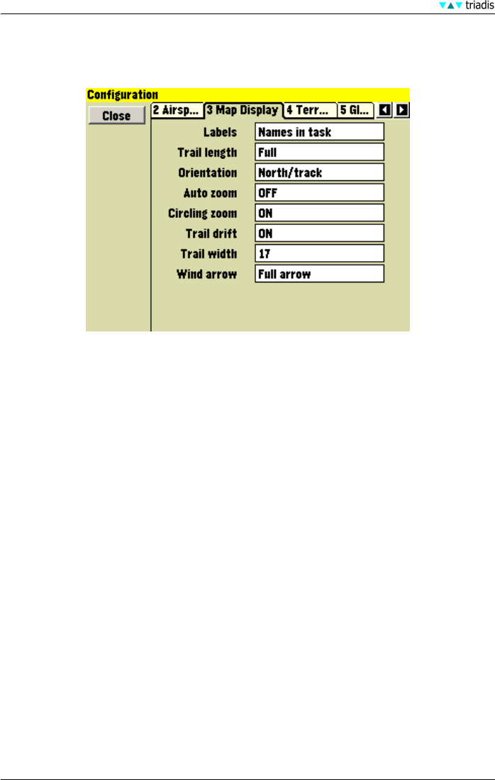
11.3 Map Display
This page has options relating to the map display.
• Labels This setting determines the label displayed with each waypoint. There are 6 options:
• Names The full name of each waypoint is displayed.
• Numbers The waypoint number of each waypoint is displayed.
• None No names are displayed with the waypoints.
• Names in task Names are only displayed for waypoints that are in the active task as well
as the home airfield.
• First Three The first 3 letters of the waypoint name are displayed.
• First Five The first 5 letters of the waypoint name are displayed.
• Trail length Determines whether and how long a trail is drawn behind the glider.
• Off No trail is drawn
• Long A long trail is drawn (approx 60 minutes)
• Short A short trail is drawn (approx 10 minutes)
• Full Displays the entire flight
• Orientation This determines how the screen is rotated with the glider.
• North up The moving map display will always be orientated north to south and the glider
icon will be rotated to show its course.
• Track up The moving map display will be rotated so the glider’s track is oriented up.
• North up when circling This is equivalent to track-up in cruise and north-up when cir-
cling.
97 XCSoar Manual (Altair version) • XCSoar-A-EN