
User manual
XCSoar User Manual
12.2 Terrain
The terrain file (extension .dat) is a raster digital elevation model
represented as an array of elevations in meters on a latitude/longi-
tude grid. The format used is unique to XCSoar as it contains a
header containing the grid geometry followed by the raster array.
Terrain files for various regions can be obtained from the XCSoar
website. Additional terrain files can be produced upon request.
12.3 Topology
The topology file (extension .tpl) is a text file containing a series
of entries each of which define a layer of topology. Typical layers
include roads, railway lines, large built-up areas (cities), miscella-
neous populated areas (towns and villages), lakes and rivers.
The topology file defines which features are to be displayed, their
colour, maximum zoom visibility, icons, and labelling. This file
can be customised, for example to add or remove specific layers.
Details on the file format will be provided in a separate document.
The topology data itself uses ERSI Shape files which are generated
from the freely available VMAP0 database.
Topology files for various regions can be obtained from the XC-
Soar website. Additional topology files can be produced upon re-
quest.
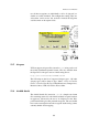
12.4 Waypoints
XCSoar uses waypoint files written in the format designed by Cam-
bridge Aero Instruments for their C302 instrument. The file exten-
sion should be .dat.
Files are available from the Soaring Turn-points section of the
Soaring Server:
http://acro.harvard.edu/SOARING/JL/TP
Several commercial and freely distributable programs exist for con-
verting between different waypoint formats.
If the elevation of any waypoints is set to zero in the waypoint
file, then XCSoar estimates the waypoint elevation from the terrain
database if available.
Furthermore, if the terrain database is available, then waypoints
outside the terrain coverage area cause a dialog to open asking the
152