
User`s guide


Use Your System 4
Agilent E6474A User’s Guide 117
Test 4 - GPS Receiver Testing
If you have an Agilent digital receiver, make sure that you have
tested the receiver using either method 1 (page 106), method 2
(page 112), or method 3 (page 114) described earlier in this
chapter. It is recommended that you know the GPS position, the
longitude and latitude, of where you do the test.
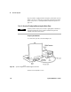
Setting Up the Hardware
1 Connect the system components per the instructions in
Chapter 3.
2 Power the system on. Allow 30 minutes for the scanner to
stabilize before testing.
3 If the system is equipped with a GPS/DR Navigation unit,
move the vehicle approximately 10 feet.
Testing the Signal
1 Start the E6474A software.
2 Refer to “Identifying the Devices" on page 94, and perform
the procedure if you have not already done so.
3 Verify that the navigator is enabled in the System Setup view.
4 Click Log > Start Logging.
5 Open the Route Map view.
Passing the Test
If the status area of the Route Map view reports the same
longitude and latitude of your current location, the GPS is ready
for use. If the navigator is not communicating, a dialog box with
an error message appears.
If you experience problems in setting up the test, refer to
“Solving Problems with Your System" on page 130.