
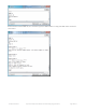
Datasheet


0 - this is the mode (will be 0)
4043.576433 - this is the longitude
7400.316980 - this is the latitude
58.647405 - this is the altitude in meters
20150601201258.000 - this is the UTC time in yyymmddHHMMSS.ms format. E.g. this is year 2015, month 06, date
01, 20 hour, 12 minute, 58 seconds. If you are not in UTC timezone you'll have to adjust this for your local time
64 - is the ttff, time to first fix, in seconds
12 - is the # of visible satelites
0.548363 - is the speed (in knots)
100.442406 - this is the best guess for 'course', e.g. which way you are heading, with 0 being 'north' and 180
being 'south' (we think)
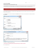
Raw NMEA out
If you want to get the 'raw NMEA' data for some reason, you can do that with E
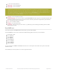
On V1 FONA808's you can send a number from 0-255 indicating which sentences you want emittted.
0 for disable output
+2 for $GPGGA
+4 for $GPGLL
+8 for $GPGSA
+16 for $GPGSV
+32 for $GPRMC
+64 for $GPVTG
+128 for GPZDA
e.g. if you want to see GPRMC and GPGGA, add +32 and +2 = 34 and put in that number. Then you'll see the data
stream out at 1Hz
On V2 FONA's you can only select 'on' or 'off' and get all sentences!
People often get confused because the GPS is working but is "5 miles off" - this is because they are not
parsing the lat/long data correctly. Despite appearances, the geolocation data is NOT in decimal degrees. It
is in degrees and minutes in the following format: Latitude: DDMM.MMMM (The first two characters are the
degrees.) Longitude: DDDMM.MMMM (The first three characters are the degrees.)
© Adafruit Industries https://learn.adafruit.com/adafruit-fona-808-cellular-plus-gps-breakout Page 44 of 57