
Specifications


718
SAFETY & NAVIGATION
Charts / Accessories
3052 Okanagan Lake
3053 Shuswap Lake
3061 Harrison Lake & Harrison River
3062 Pitt River & Pitt Lake
3312 Jervus Inlet & Desolation Sound
3313 Gulf Islands
3488 Fraser River-Crescent Island to Harrison Mills
3489 Fraser River-Pattullo Bridge to Crescent Island
3512 Strait of Georgia-Central Portion
3311 Sunshine Coast, Vancouver Harbour
Canadian Hydrographic Charts
In Addition to the popular charts above we carry a large stock
of marine charts. Please feel free to call us to enquire after your
specicneeds.
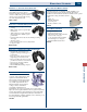
Davis Chart Holder
This tubular, plastic chart holder
isweatherproofandoats.Large
enough to hold most marine
charts. Includes
identicationlabel.40"x3"diameter.
DIN 086
Binnacle Vinyl Chart Cases
Heavy #10 gauge vinyl with heat sealed edges.
Vinyl zipper and non-glare surface.
BIN 6 10" x 16-1/2"
BIN 7 18" x 24"
BIN 8 24" x 36"
Canadian Government Publications
PUB P244 Current Atlas - Juan de Fuca
PUB P118 Vol.-1 Sailing Directions
PUB P202 2009 Radio Aid to Navigation
PUB PAC200E Pacic Coast General Information
PUB PAC205E Sailing Directions Inner Passage-Queen
Charlotte Sound to Chatham Sound
PUB PAC206E Hecate Strait, Dixon Entrance, Portland Inlet
and Adjacent waters and Queen Charlotte
Islands
PUB P185 2010 Tide Table Vol 5 (Juan De Fuca Strait &
Strait of Georgia)
PUB P186 2010 Tide Table Vol 6 (Discovery Passage
including Port Hardy & West Coast
Vancouver Island)
PUB P187 2010 Tide Table Vol 7 (Queen Charlotte
Sound to Dixon Entrance)
PUB P211 Lights Buoys & Fog Pacic 2007
PUB P468 Notices to Mariners Annual 2010
PUB CHR1 Symbols, Abbreviations, Terms
C-MAP Electronic Charts
Some C-MAP features:
Multi-Media Objects-aerial photos & dia. of marinas•
Seamless Coastal Roads•
Points of Interest (POIs)•
Tides and Currents•
Dynamic Elevation Data•
Display the charts in a new Perspective (3D) mode•
Chart can be panned/zoomed•
C-MARINA Port Plans•
► Also See:
Product Details pg 177-178
►NOTE: Sold to the End User Only